 Object Detection
The Object Detection tool allows users to identify buildings and vehicles contained in high resolution aerial imagery. The tool has two main components: Building Extraction, and Vehicle Detection.
|
|
This tool requires Global Mapper Pro |
This tool can be accessed from the Deep Learning (Beta) Drop-down Menu, or from the Deep Learning (Beta) Toolbar.
Building Extraction
Building Extraction allows for identification of building features from imagery. This process can create vector building footprints and a binary raster output. The model is trained on:
-
3 spectral band aerial imagery, 0.3 meter resolution
Post-processing
Check the Apply post-processing option to modify the output building footprint area features:
-
Simplification - Check this option to simplify building footprints. This will remove extra vertices, resulting in a smoother appearance.
-
Regularization - Check this option to regularize building footprints so that corners become 90 degrees and opposite walls are parallel.
Output
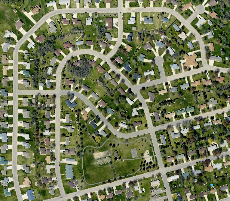
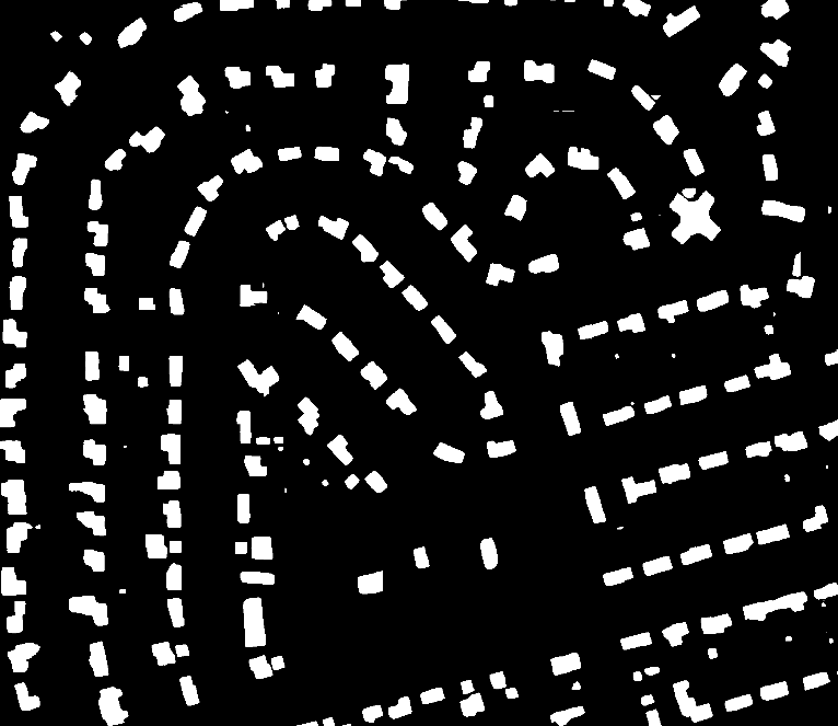
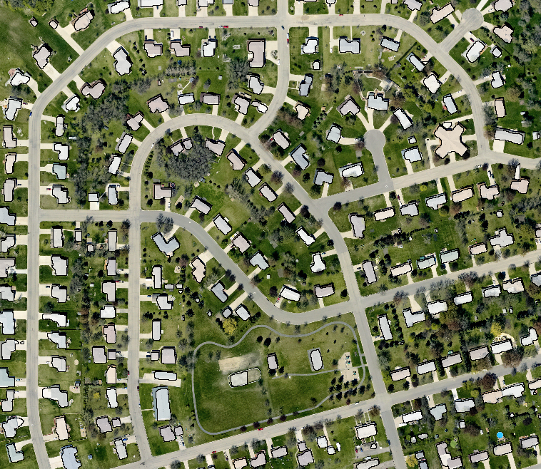
Images above left to right: original image, binary raster output, building footprint area features.
Vehicle Detection
Vehicle Detection identifies vehicles in high resolution imagery. Vehicles are identified with a vector bounding box. The model is trained on:
-
3 spectral band aerial and satellite imagery, 0.15 meter resolution
Output
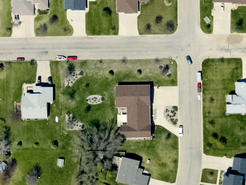
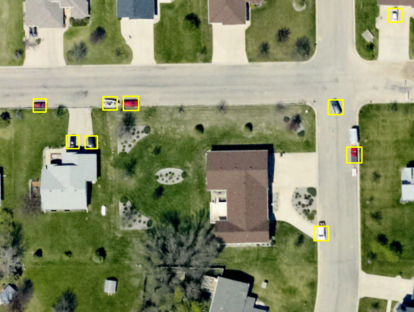
The image above shows the vector bounding boxes generated identifying vehicles within the input imagery.
Custom Models
Select the custom models tab to specify a previously saved model created with the Fine-Tuning tool to use for Building Identification and Vehicle Detection. Built-In and Custom Models can be download and managed from the Configuration menu.
Bounds
Specify the bounds for processing using Global Mapper's Bounds dialog. Pixels outside of the specified area(s) will be excluded from processing.