 Land Cover Classification
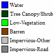
Land Cover Classification provides users with the ability to identify a variety of land cover classes (Water, Tree, Low Vegetation, Barren, Impervious-Other, and Impervious-Road) from aerial imagery. Two different built in classification models are provided:
-
3 spectral bands trained on aerial NAIP imagery, 1 meter resolution
-
4 spectral bands trained on aerial NAIP imagery, 1 meter resolution
![]() This tool requires Global Mapper Pro.
This tool requires Global Mapper Pro.
This tool can be accessed from the Deep Learning (Beta) Drop-down Menu, or from the Deep Learning (Beta) Toolbar.
Built in Models
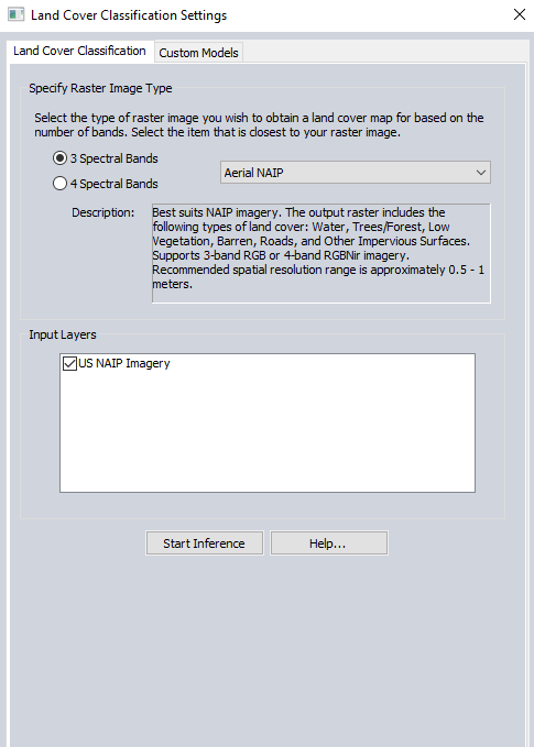
Specify Raster Image Type
Specify the characteristics of the input imagery that will be used to perform the classification. While the type and source of the imagery may not be the exact same from the available options, users should select the options which are closest to those of your raster image. These settings will determine which of the three available built in models will be used to perform the classification.
NAIP Imagery - Three or four spectral band NAIP imagery can be used.
Land Cover Types
Input Layers
Four band NAIP imagery input data can be divided into separate layers. This section allows for the specific layers to be used as input for the classification to be selected.
Start Inference
Select the Start Inference option to perform the classification once the input raster type has been specified.
Custom Models
Select the custom models tab to specify a previously saved fine tuned model created with the Fine-Tuning tool to use to classify imagery.