Viewer
The Blue Marble Calculator contains a built-in viewer for displaying both vector and raster file formats. You can access this window by selecting the View button or selecting Window>Viewer from the drop-down menu. Some options for the Viewer can be set in the Viewer tab of the Preferences dialog.
Note: The Viewer window does not perform any 'reprojection on the fly' to transform data in different coordinate reference systems into a common reference frame. It will only render data using the coordinates specifically defined in the input, and this is intentionally so that it may be used to quality check the exact coordinate values.
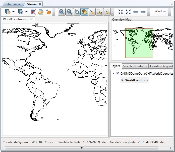
Add a layer
to the window by selecting the ![]() Import
Data Into New Map button on the Left of the Viewer toolbar. If detected, the coordinate system of
the data will be displayed in the lower left corner.
Import
Data Into New Map button on the Left of the Viewer toolbar. If detected, the coordinate system of
the data will be displayed in the lower left corner.
If the loaded data has no reference information a dialog will appear with options to specify how to handle the referencing. For raster data, the following dialog will appear:
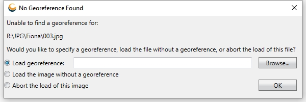
Specify a reference file, load the image with no georeference in pixel coordinates, or choose to cancel the image load. See also Viewing Tabular Data for information about specify coordinates in tabular data.
To change the background color to a more contrasting value, go to Options > Preference and navigate to Viewer tab to change the default background color.
To change the appearance of particular layers in the viewer, right-click on the layer name in the Vector Layers list on the right and select Appearance. A menu will pop-up allowing you to select from various point, line, or polygon styles.
There are a number of different tool buttons available in the viewer:
 Add an Area of Use polygon
from GeoCalc
Add an Area of Use polygon
from GeoCalc