ASRP and ADRG File
Loading
ADRG is a raster format typically used by military and other government organizations. To load ADRG files, load the TRANSH01.THF file from the ADRG file hierarchy or load the ADRG data directly from a .zip file. Global Mapper v6.02 and above can load files in this format.
ASRP is a raster format typically used by military and other government organizations. The USRP varient simply uses a UTM projection rather than unprojected lat/lon. To load ASRP/USRP files, simply load the TRANSH01.THF file from the ASRP/USRP file heirarchy or load the ASRP/USRP data directly from a .zip file. Global Mapper v6.07 and above can load files in the ASRP format. Global Mapper v7.04 and later can also handle the USRP files.
Exporting
To export loaded data to an ASRP or ADRG file, choose File > Export > Export Raster/Image Format... then select ASRP/ADRG File from the Select Export Format list
The Export ASRP/ADRG command allows the user to export any loaded raster, vector, and elevation grid data sets to a 24-bit RGB ASRP (1.1 or 1.2) file, or to an ADRG format.
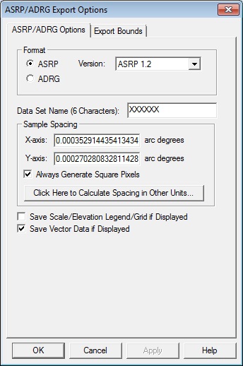
When selected, the command displays the ASRP/ADRG Export Options dialog which allows the user to setup the export. The dialog consists of a General options panel and an Export Bounds panel which allows the user to set up the portion of the loaded data they wish to export.
General Options
Format
Specify the desired output format. With an ASRP output, select the version.
Data Set Name - Specify a 6 character name for the data set.
