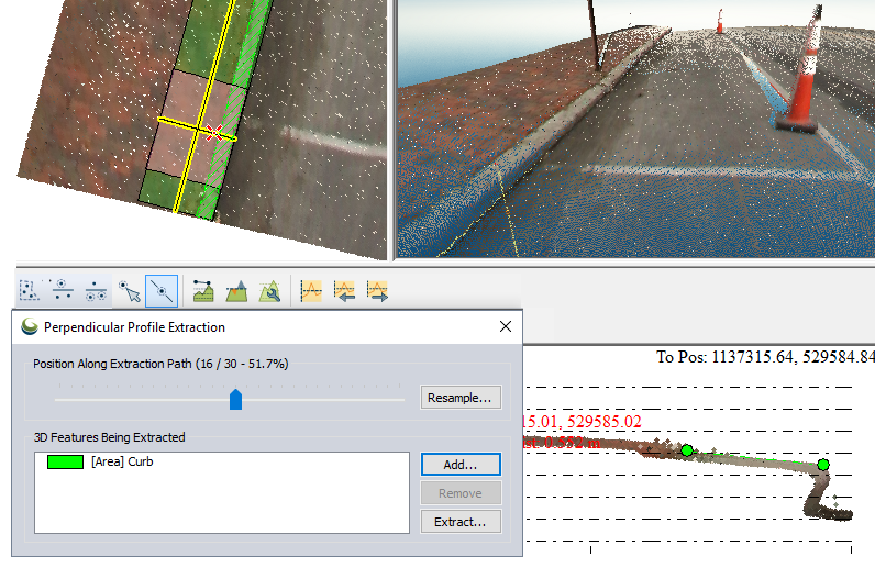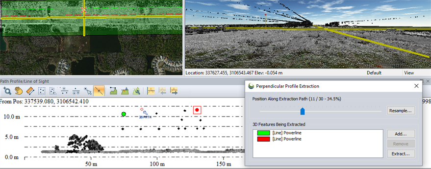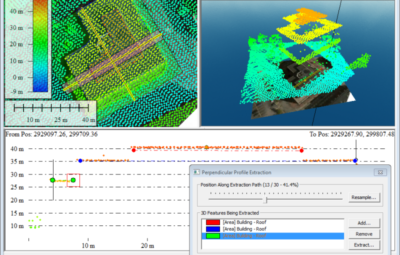
The Custom Feature Extraction tool enables extracting 3D linear and area features using the Perpendicular Path Profile view. This tool requires a Global Mapper Pro license. The extraction is accomplished by locating control vertices through a series of perpendicular path profiles. The selected point location from each sequential profile is then used to build a very accurate 3D line or area feature.
![]() This tool requires Global Mapper Pro.
This tool requires Global Mapper Pro.

Extraction Process
To begin a Custom Feature Extraction, first create a Path Profile along the length of the feature. Turn on the Perpendicular Path Profile view using the Path Profile Settings  .
.
If the current Path Profile was generated from a 2d line feature, per vertex elevation can be applied prior to performing the feature extraction.
Start a new 3D Feature Extraction session by clicking the  Extract Along Perpendicular Profiles button. Press the Add... button to start a new feature. Define the feature using the Specify New Feature Details dialog. After specifying the feature details, place the first control point or segment in the Path Profile window to begin creating the 3D feature. The
  select new vertex tool should be active. (See more information on creating a 3D Line Feature or 3D Area Feature).
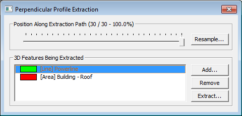
The Perpendicular Profile Extraction dialog shows the position along the extraction path, marking the location of each perpendicular profile. The dialog also manages the creation and extraction of 3D feature. Step through the subsequent path profiles using the slider, left and right arrow keys on the keyboard, or the 
 arrow buttons in the Path Profile window. Move any vertices that need to be relocated in subsequent profile views using the
  select and drag vertex tool.
Use the Resample... button to modify the spacing of the Perpendicular Paths. In each subsequent Perpendicular Path Profile view, move any vertices that do not align with the reference data. If the feature being created does not continue the full length of the path, use the options in the right-click menu to specify an intermediate Start or Stop location for the feature.
The path profile toolbar allows access to the different feature editing options in the Profile Window. This allows you to switch between placing new feature vertices, moving vertices, or using other tools with existing data.
When the feature has been completed, use the Extract... button to create a 3D Vector feature. 3D Features will not be saved unless they are extracted.
Optimizing the Display for Custom Feature Extraction
To create a Custom Feature Extraction you must enable Perpendicular Profile view using the Path Profile Settings  . The Perpendicular Path Length settings determines the length of the x-axis in the perpendicular profile window. You can also use the Elevation Range /Scale settings to control the y-axis as you move through subsequent Perpendicular Profiles. You can also use the Restrict Elevation Range Near Extracted Features setting to automatically restrict the elevation to a set range around the feature being extracted.
Custom Feature Extraction can also be optimized by setting up multiple map views. The features being actively extracted will display in 2D map views using the specified Profile Dot Color. This can facilitate the custom feature extraction process by allowing you to see the feature(s) being extracted from multiple perspectives.
In the Path Profile settings you can also check the option to Draw Line/Area Features that Cross Path in order to add vector data locations as reference in the Path Profile view.
With Lidar data loaded, the Perpendicular Profile view also has a corridor width. Use the Max. Distance from Path to Show [Perp] to adjust the depth of Lidar points being drawn in the path profile view in relation to the Perpendicular Path.
On the perpendicular profile extraction window, use the Resample... button to modify the spacing of perpendicular profiles along the path. You can use this to set the approximate resolution at which you would like to extract feature vertices.
How Feature Vertices Are Determined
The default vertex location for each perpendicular profile is determined by interpolating between the manually specified vertex locations. When you explicitly move a point on a perpendicular path that point is then anchored and will be used to interpolate any surrounding automatically placed points. This means that specifying the vertex locations in the first perpendicular path profile and the last perpendicular path profile that contain the feature may be a good starting point for creating the 3D feature. This also means that if a feature has moved only slightly, you could choose to skip to the next Perpendicular path profile before updating the location of the vertex. The intermediate vertex that was not manually specified (moved) will update to smoothly interpolate between the explicitly defined vertices.
Custom Extraction of 3D Line Features

For Linear features, create a Path Profile following the length of the linear feature. Enable the Perpendicular Profile view and determine the best Perpendicular Path Length to use for the Profile view. Also set the Max. Distance from Path to Show [Perp] if using Lidar data.
Click the  button to begin the Custom Feature Extraction. Define the first feature using the Specify New Feature Details dialog, and then place a vertex on the perpendicular profile to place the first vertex of the line. The line will appear in the 2d map view as a dashed line.
Use the Position Along Extraction Path slider to move through subsequent path profiles and place additional vertices. If multiple line features run parallel through the space, select more than one feature vertex to move them at the same time.
Perpendicular Path profile views interpolate the location of the feature from vertex locations specified on surrounding (previous/ subsequent) path profiles. See more information about how vertex locations are determined.
If the line feature does not run the full length of the Path right click on the Path Profile to start or stop the path of selected feature at the visible path profile. When the vertices are sufficiently captured for the linear feature, use the Extract... button to create a new linear feature.
Custom Extraction of 3D Area Features
3D area features can be extracted by placing the exterior vertices of the area feature in Perpendicular Profile views. Because 3D vector features only have vertices at the edges of the feature, complex 3D vector features must be broken down into planar subsets.

To create a custom area feature extraction choose an area type from the Specify New Feature Details dialog. If the feature is Flat, choose the option to Use the Same Elevation for each vertex. Left-click to place the first vertex of the area feature on the Perpendicular Path profile view. Then-right click to place the last vertex. The Area feature will appear on the 2D Map View with a cross-hatch fill pattern.
For area features that are adjacent, or complex 3d features with multiple faces, the vertices of area features will snap together automatically when dragged in close proximity to existing vertices.
Use the Position Along Extraction Path slider to move through subsequent Perpendicular Profile views and reposition vertices. If the feature has a fixed width, select and move both vertices of the line segment at the same time to maintain a constant width.
If the area feature does not run the full length of the Path right click on the Path Profile to start or stop the path of the selected feature at the visible path profile. When the vertices are sufficiently captured for the area feature, use the Extract... button to create a new area feature.
Specify New Feature Details

When the Perpendicular Profile Extraction button is pressed, the Specify New Feature Details dialog will appear. This dialog also appears when pressing Add... from the Perpendicular Profile Extraction window. Determine the geometry type and the Feature Type using the drop downs. Once the new feature has been defined, click the vertex location in the Path Profile view to place the first vertex for the feature.
Use Same Elevation for Each Vertex (i.e. Flat Feature) - This option fixes the elevation of the feature at the first specified vertex location. This option is useful for features that should have flat tops, where every vertex has the same elevation/ height value, for example flat buildings roofs.
Profile Dot Color... - This option allows choosing the color of the feature being extracted. The feature will appear in this color in the Perpendicular Profile view and also in the 2d map view with a diagonal cross-hatch fill pattern.
Perpendicular Profile Extraction
Position Along Extraction Path - This slider bar shows the location of the Perpendicular Profile view along the path. Click and drag the slider to adjust the location displayed in the Path Profile view. The marks indicate the locations of Perpendicular Profiles along the length of the path.
Resample... - Determines the Path Profile Spacing Setup.
3D Features Being Extracted - Displays the current features being specified in the Perpendicular Path Profile view. Double click on a feature to modify the feature details.
Add... - Brings up the Specify New Feature Details dialog and begins the creation of a new feature for extraction.
Remove - Removes the selected 3D Feature
Extract... - Creates a 3D feature from the selected 3D Features or All 3D Features in the list. This will bring up the Modify Feature Info dialog for each Feature geometry type (Line or Area feature).
