GPX (GPS eXchange Format)
The Export
GPX (GPS eXchange Format) commands allows the user to export any loaded
point and line data to a GPX (GPS eXchange Format) file.
When selected,
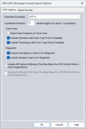
the command displays the GPX Export Options dialog which consists of an
Export Bounds panel that allows the user to set up the portion of the
loaded vector data they wish to export.

If you want to fill in the <cmt> field of a feature during a GPX export, simply add a COMMENT attribute to the feature with the desired comment.
Coordinate Precision can be specified as an integer indicating the number of decimal digits to use.
In the Track Lines section, are options for including Elevation and Time Stamp information for each Track Point, as well as exporting track Area Features as Lines and including Waypoint Symbols.
Attribute Features may also be included in the export, though not all hardware
or applications will support attributes included in a GPX file format.