MapBox Vector Tileset
Load MapBox Vector Tiles
Global Mapper can load data from MapBox Vector Tiles (*.mbtiles) format. This data will load as a base map and the imported features cannot be selected or edited in Global Mapper.
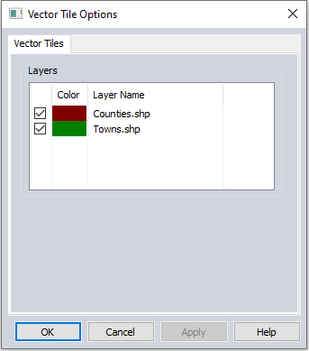
The Layer Options for MapBox Vector Tile layers allow the user to specify a color for a feature layer and hide specific data layers from the file.
Export to MapBox Vector Format
MapBox Vector Tiles export is available from the menu File > Export > Export Vector/Lidar Format... and File > Export > Export Web Format...
Exported vector data will be exported to a single MapBox Vector Tiles database file. Within the exported database a separate MapBox Vector Tile layer will be created for each vector layer exported from Global Mapper.
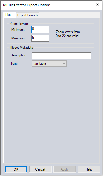
Zoom Levels
Set the minimum and maximum zoom levels to be used for the export.
Simplification
The simplification slider allows the user to set the threshold at which points that don't contribute much to the shape of the vector features and are removed in order to export features with fewer vertices. None will apply no simplification and keep vector features as they are currently. Use a greater simplification threshold (toward Max) to reduce the size of the exported files.
Tileset Metadata
Description: Enter a Description for the map
Type: Indicate whether or not the map is a base layer or overlay layer.