The Export
3D PDF File command allows the user to export any or all of the loaded
data to a Geo-enabled 3D PDF file. These are PDF files that can be read
in Adobe Acrobat Reader. They also will have geo-positioning information
embedded in them so that mapping applications like Global Mapper can automatically
display the data in the PDF at the proper location. The 3D PDF export option is available in the File> Export menu under Export 3D Format..., Export Raster/Image Format..., or Export Vector/Lidar Format... and is listed as PDF (3D).
When selected, the command displays the 3D PDF Export Options (below) dialog which allows the user to setup the 3D PDF export. The dialog consists of a PDF Options tab, a Tiling tab, and an Export Bounds tab.
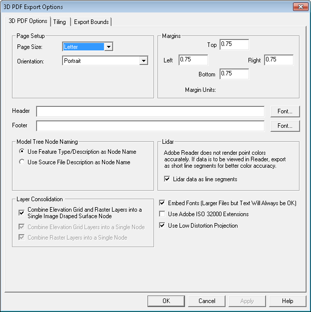
The 3D PDF Options tab allows the user to setup the PDF-specific export options. The following sections are available:
Page Size - The page size setting controls the target paper size for the export.
Orientation - This setting controls whether the target page uses landscape or portrait orientation.
Fill Page - If checked, your specified export bounds will be expanded to fill the entire page if necessary. If you do not check this option, only your exact export bounds will be exported with the rest of the page remaining blank.
This section sets up the size of the white margins around the data. Specify the margin size on each side of the output page.
Header - Allows you to specify a header text to draw in the top margin of the output file.
Footer - Allows you to specify a footer text to draw in the bottom margin of the output file.
Layer Naming - This section controls how Nodes will be named in the created 3D PDF. Naming options include: using layer Attributes layer names, using the Feature Type/Description as Layer Name, the feature type name/description will be used as the layer name in the 3D PDF file and using the Source File Description as Layer Name will use the Control Center layer name for the layer that the feature is in will be used as the PDF layer name.
Combine
Elevation Grid and Raster Layers into a Single Image Draped Surface Node
- Combines all elevation grid layers and drapes all overlapping
raster layers over it. If an image draped surface cannot be created (no
elevation layer, no raster layer, or no overlap), then any elevation grid
layers will be combined and exported as one node, and any raster layers
will be combined and exported as another node.
Combine Elevation Grid Layers into a Single
Node - Combines all elevation grid layers and export as a single
node. Otherwise, one node will be created for each layer. Disabled if
image draped surface option set.
Combine Raster Layers into a Single Model Node - Specifies that
if multiple raster or gridded elevation data sets are involved in the
export, they will be combined into a single model node in the generated
3D PDF file.
Embed Fonts - Specifies that any fonts used that might not be on every system will be embedded in the 3D PDF file. Using this option will ensure that your text will display the same on any system, but unless you are using an unusual font the increase in PDF file size might not be worth it as most users would have your font anyway.
Use Low Distortion Projection - This option will typically produce better results by transforming the data to an orthographic projection centered on export bounds.
Use Adobe ISO 32000 Extensions - If unchecked, we will use standard GeoPDF georeferencing.
If any of the point features being exported contain an attribute with LINK in the attribute name and a value either pointing to a valid web URL or a local file, then a clickable hot-spot will be embedded in the generated 3D PDF file allowing you to click the location and pull up the web page or file from inside Acrobat Reader.
The Tiling panel allows the user to split up the data into regularly spaced tiles on export if desired rather than just exporting a single file.
The Export Bounds panel allows the
user to select what portion of the loaded data they wish to export.