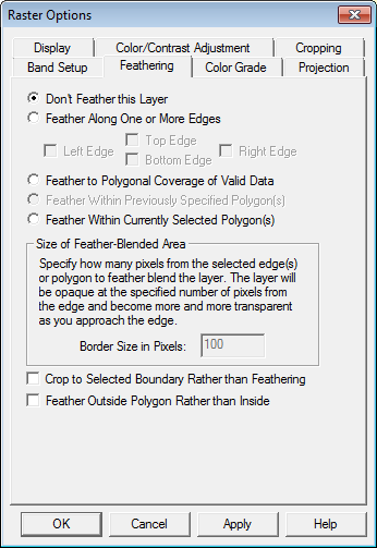
The Feathering
tab (pictured below) allows the user to feather-blend selected overlay(s)
with the underlying overlay(s) on specified edges. This can be extremely
powerful tool for blending imagery/ maps from different sources and/or
at different resolution to make the edge between the map sets invisible.
Users can also choose to either feather-blend around the edges of selected
files or along the boundary of one or more selected polygons. Feather
blending can be used on both raster (imagery) layers as well as gridded
elevation layers.
For elevation layers, feather blending works by calculating modified elevation values based on elevation value in the blended layer and the topmost elevation layer underneath the blended layer in the draw order.
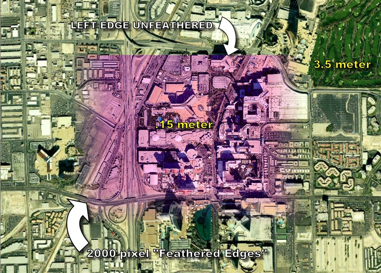
The example below displays the results of feather-blending a very high resolution data set (0.15 meters per pixel) with a lower resolution (3.5 meters per pixel) dataset to remove the edge. Note that the higher resolution image has been purposely tinted violet to make the effect more obvious.