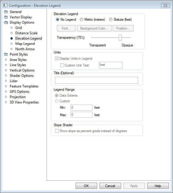
The Elevation Legend section of the Configuration Display Options dialog controls the display of an elevation legend with loaded elevation data. This legend is applicable to any gridded data that has been loaded as terrain data.
These settings are also accessible by right clicking on a Elevation Legend element.
To specify the interpretation of units for terrain data, see the Elevation Units Interpretation in Layer Options.

No Legend
No elevation legend will be displayed.
Metric (meters)
The elevation legend will be labeled in metric units.
Statute (feet)
The elevation legend will be labeled in statute units.
Font...
Customize the font used in the distance scale.
Background Color...
Customize the background color of the distance scale.
Position...
Specify where in the map frame the element will be displayed.
Transparency
Use the slider to control the opacity of the element.
Display Units in Legend
Check this option to label the elevation legend with units.
Custom Unit Text
Customize the unit label applied to elevation values in the legend.
Specify a title for the top of the legend. This is particularly useful when the data represents values other than elevation.
Data Extents
The elevation legend minimum and maximum will be calculated from the displayed data extents.
Custom
Use this settings to customize the minimum and maximum values on the elevation legend. The units are controlled above.
Show Slope as Percent Grade Instead of in Degrees
Check this option to label the Slope Shader in percent grade rather than degrees.