Create Fitted Coordinate System
The Create Fitted Coordinate System Tool can be directly accessed from the Georeferencer Tools menu. Note that you will need to have source data loaded in the Source Data Viewer to create a fitted coordinate system, and you will need a minimum of three reference points selected.

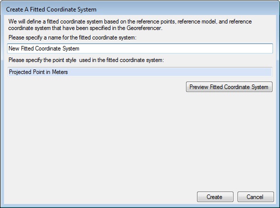
Selecting the menu option will bring up the Create A Fitted Coordinate System dialog:

A similar version of this dialog will display as part of the Projection Recovery Tool and will also display if you are attempting to recover a projection and select "None of the above" from the results list.

In both cases, you may then specify a name for your fitted coordinate system. You may also specify a point style by double-clicking on the blue point style box to bring up a picker dialog. Clicking on Preview Fitted Coordinate System will display the details of the new system. If you are content with the new fitted coordinate system, click Create or Finish (depending on which version of the dialog you are in). To discard the system and return to the Georeferencer, click Cancel. In the case of the Projection Recovery Tool version of the dialog, you may also click Back to return to the list of possible projections.
Clicking Create or Finish will prompt the user with the following message:

If you wish to ensure the new fitted coordinate system is saved for future use, click Yes. If you click No the system will still be available during the current session, and you will be prompted again to save changes if you close the Calculator application. The fitted coordinate system will be found in the Fitted folder of the Coordinate System Selection dialog.