Browsing the Geodetic Datasource
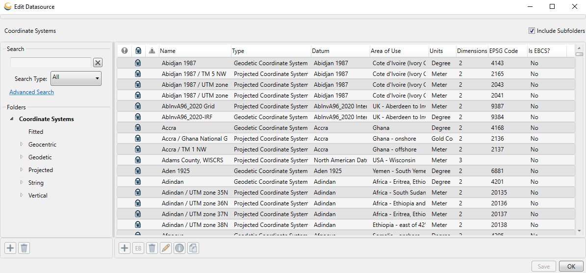
To view the contents of the Geodetic Datasource, you can use the Datasource menu. Each type of object in the datasource has its own entry in the Datasource menu. For example, to browse available coordinate systems, go to Datasource > Coordinate System Definitions.

Users may customize the size of the dialog, the position of the splitter between the Folder and Object panels, and the order and width of the columns displayed for each type of object. Columns may also be hidden by resizing the column.
Folders
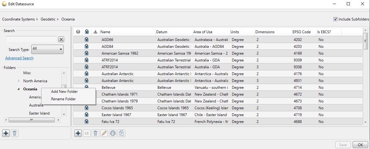
On the left-hand side of the dialog is the Folders list. This list is a typical Windows Explorer style tree view that will organize whichever type of object you are browsing into folders. To explore the sub-folders of a folder, click the triangle to the left to see the folders listed underneath. To see the entries at any particular level of folder, click the folder itself.

With a folder selected, the pane to the right will list the individual objects within the folder.
For more information on creating, renaming, rearranging and deleting folders, see Working with Folders.
Objects
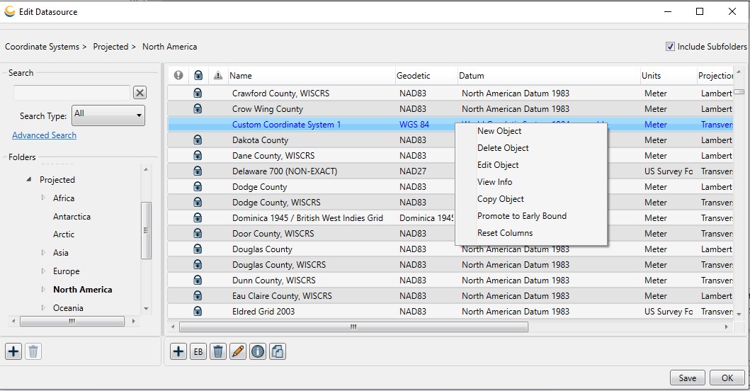
When browsing the available objects under a given folder, entries loaded from the main Datasource are read-only and shown in black text with a lock icon beside them. Entries from the Custom parameter file are shown in blue and do not have a lock icon beside them.
The individual objects can be selected and the parameters of those objects
viewed by double-clicking the object in the right hand pane. If
the object is read-only you will only be able to view the parameters,
and will not be able to change them. You may, however, make an editable
copy of it.
Objects that have been deprecated will be marked with a yellow warning sign. Deprecated objects will only be displayed if the 'Show deprecated datasource objects' checkbox has been checked in the Datasource Filters tab of the Administrative Settings dialog.
Objects that are not currently usable for some reason (i.e. transformations that rely on grid shift files not currently available) will be marked with a red exclamation point. If not also locked, these objects will be editable, but may only be saved if the edits make the object usable. In other words, you will not be allowed to save an unusable object.
Several actions can be performed by right-clicking on the Details Pane and using the resulting context menu. With the context menu, it is possible to add new objects, as well as delete, rename, edit, and copy existing objects.

Note: When browsing through
the datasource some objects may be flagged with a red exclamation point
![]() symbol. These objects are incomplete definitions.
The Geographic Calculator includes a number of datum transformation
definitions that require supplementary data files to function properly.
Some of these include horizontal datum transformations and geoid
models. These objects cannot be used until the supplementary files
are added. Some of these are available at our website (https://www.bluemarblegeo.com),
while others are proprietary and must be purchased or requested from a specific government
agency.
symbol. These objects are incomplete definitions.
The Geographic Calculator includes a number of datum transformation
definitions that require supplementary data files to function properly.
Some of these include horizontal datum transformations and geoid
models. These objects cannot be used until the supplementary files
are added. Some of these are available at our website (https://www.bluemarblegeo.com),
while others are proprietary and must be purchased or requested from a specific government
agency.
See Also: Defining New Objects
Searching for Objects
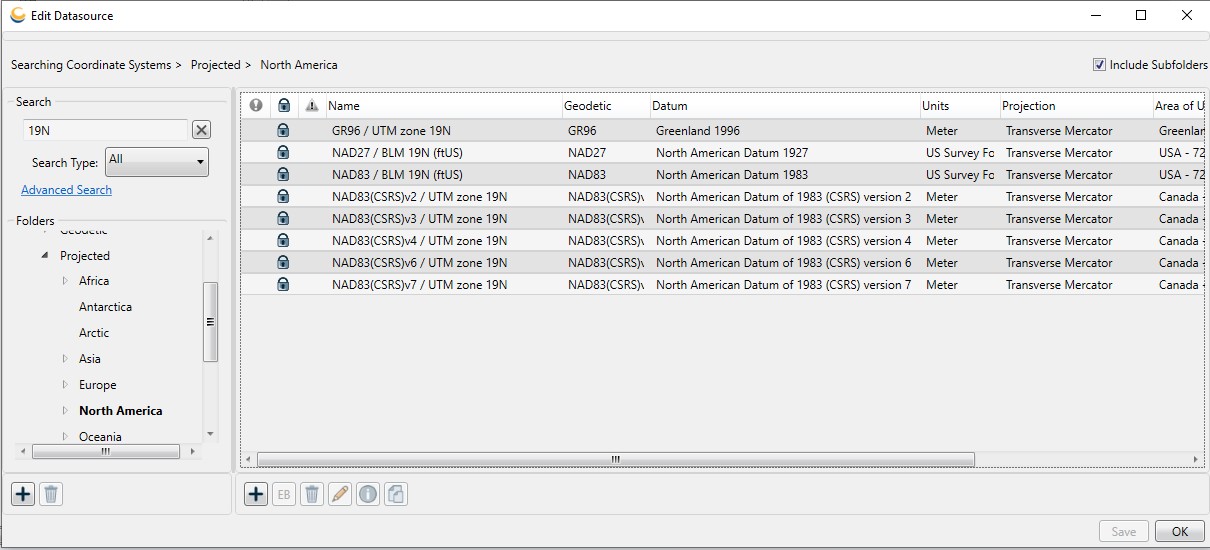
To perform a search, type your search criteria in the text field, and the filter will be automatically applied to the list of objects in the datasource. A folder may be selected to limit the search to that folder (as seen in the "North America" example above).
Optionally, use the Search Type drop-down list to limit the search results to matching name, remarks, codes, or recent. Choosing "Recent" will show you a list of your recently used objects.
Clicking Advanced Search launches a new window for performing a multi-parameter search within the geodetic datasource.
