Area Calculation
An Area Calculation job can be created by selecting the option from the Start Page or File > New > Job > Area Calculation.

The Area Calculation job contains multiple sub tabs for Settings, Base Viewer, and Grid Viewer.
Settings
The tabular grid in the Settings tab is used to enter points that will be vertices of the polygon.
Right-click on the grid area to manually add a new row or paste data from an external table.
New points can be entered as either geodetic or projected coordinates.
Use the CTRL or SHIFT keys on the keyboard to highlight multiple rows for bulk editing.
Right-click and choose delete or press the delete key on the keyboard to delete the highlighted rows.
Area Calc System - Displays the projected coordinate system for the point list and area calculation. Double click the System box to open a standard Geographic Coordinate System Picker, limited to projected systems. Double click the Units box to change the units for a particular projection.
Data Settings
Data Settings are at the bottom right of the Area Calculation job Settings tab.

In System - Specify the system on which to calculate the area. Selecting Geodetic will cause the Calculator to compute the area on the ellipsoid surface of the Base Coordinate System. Grid line segments will be interpolated polylines. Selecting Projected will cause the Calculator to compute the area on the grid plane surface of the Grid Coordinate System. Geodesic line segments will be interpolated polylines.
Area - This box will display the area (in square kilometers, by default) of the most recently processed area polygon. Text can be copied from the Area box and pasted or saved in other applications.
Units can be changed from the default by choosing from the drop down menu (conversions below) or a Linear Option.
| Area Unit Conversion Factors (Meters2 / [unit]) | |
| U.S. Survey Acres (U.S. Feet) | 1 / 0.000247104369225325 |
| International Survey Acres (International Feet) | 1 / 0.00024710538146717 |
| Hectare | 1 / 0.0001 |
Process - Click Process to calculate the area of the polygon. The area will be displayed in the Area box. The polygon will be displayed in the Base Viewer and Grid Viewer tabs, and the Area Polygon tabular grid will be populated with coordinate values in both geodetic and projected measurements.
Viewers
![]() Zoom In - Click on the map to perform a fixed zoom in on the clicked location. (Rolling the mouse wheel over the map can also be used to zoom when in any tool. )
Zoom In - Click on the map to perform a fixed zoom in on the clicked location. (Rolling the mouse wheel over the map can also be used to zoom when in any tool. )
![]() Zoom Out - Click on the map to perform a fixed zoom out from the clicked location. (Rolling the mouse wheel over the map can also be used to zoom when in any tool.)
Zoom Out - Click on the map to perform a fixed zoom out from the clicked location. (Rolling the mouse wheel over the map can also be used to zoom when in any tool.)
![]() Zoom To Rectangle - Drag a rectangle on the map to zoom to that extent.
Zoom To Rectangle - Drag a rectangle on the map to zoom to that extent.
![]() Pan - Click and drag to move across the map. Click and drag of the mouse wheel can also be used to pan when in any tool.
Pan - Click and drag to move across the map. Click and drag of the mouse wheel can also be used to pan when in any tool.
![]() Recenter - The cursor will display a recenter icon. Click on the map to recenter at the clicked location.
Recenter - The cursor will display a recenter icon. Click on the map to recenter at the clicked location.
![]() Reset Map - This will reset the map to the full extent of the data.
Reset Map - This will reset the map to the full extent of the data.
![]() Go To Previous View - Use this back button to move back through previous zoom levels and locations
Go To Previous View - Use this back button to move back through previous zoom levels and locations
![]() Go To Next View - After using the Go To Previous View button, the Go To Next View button will move forward again through stored map navigation.
Go To Next View - After using the Go To Previous View button, the Go To Next View button will move forward again through stored map navigation.
![]() Export Geometry To Vector File - Save the area to an external vector file format :AutoCAD (*.dwg or *.dxf), Esri Shape (*.shp), GML - Simple Features (*.gml), Keyhole Markup Language
(*.kml, *.kmz, only valid with Base geodetic data), MapInfo TAB (*.tab), MicroStation Design (*.dgn). See Opening and Saving Area Calculation Data for more information.
Export Geometry To Vector File - Save the area to an external vector file format :AutoCAD (*.dwg or *.dxf), Esri Shape (*.shp), GML - Simple Features (*.gml), Keyhole Markup Language
(*.kml, *.kmz, only valid with Base geodetic data), MapInfo TAB (*.tab), MicroStation Design (*.dgn). See Opening and Saving Area Calculation Data for more information.
Base Viewer
When you calculate an area, the polygon that defines that area will automatically be displayed in the Base Viewer tab with geodetic (latitude/ longitude) coordinates.
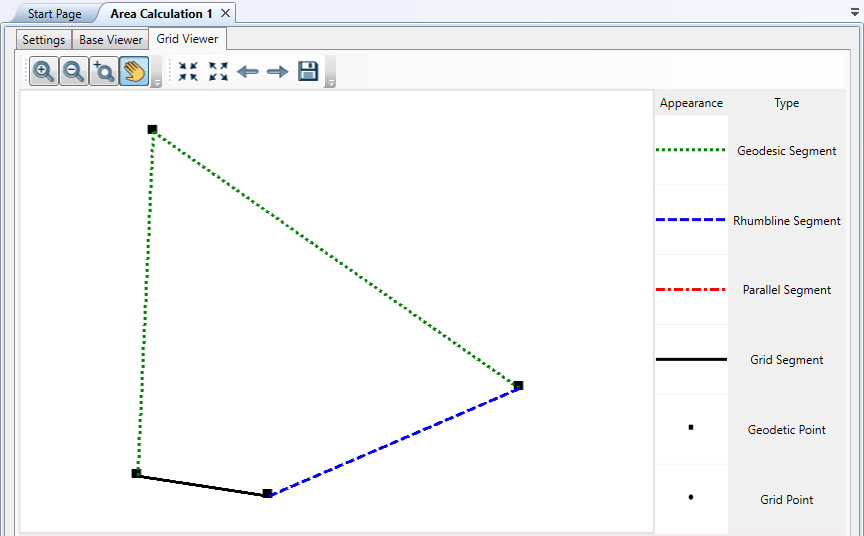
Grid Viewer
When you calculate an area, the polygon that defines that area will automatically be displayed in the Grid Viewer tab, in the projection selected in the "Area Calc System" box.